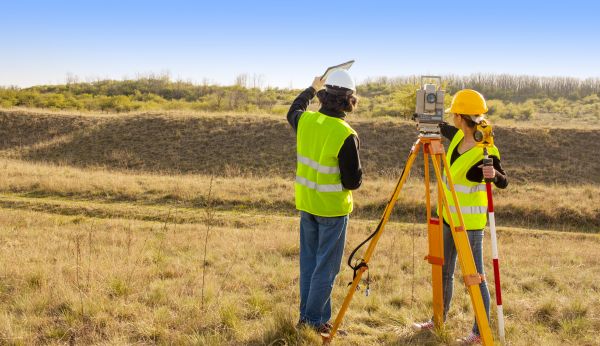
Land Surveying Service
Affordable Land Surveying Service
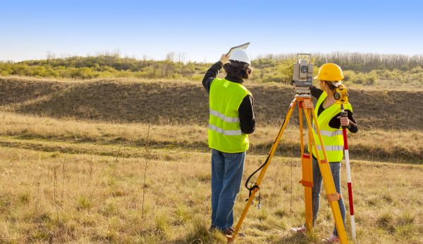
Land surveying is a crucial service that involves the precise measurement and mapping of land boundaries. This process is essential for determining property lines, facilitating the development of land, and ensuring legal compliance in real estate transactions. Whether for residential, commercial, or industrial purposes, land surveying provides the foundational data required for construction projects, land division, and land ownership disputes. By employing advanced technology and skilled professionals, land surveying delivers accurate and reliable information that is vital for informed decision-making and strategic planning.
Benefits of Land Surveying Service
-
Accurate Property Boundaries
Understanding the exact boundaries of a property is essential for avoiding legal disputes and ensuring proper land use. Land surveying provides precise measurements that clarify property lines, helping property owners avoid encroachments and legal issues with neighbors. -
Enhanced Property Value
By clearly defining property dimensions and identifying potential for development, land surveying can enhance the overall value of a property. Accurate surveys can uncover opportunities for expansion or improvement, making the property more attractive to potential buyers or investors. -
Informed Decision-Making
Land surveying delivers detailed topographical data that is crucial for making informed decisions about land development. Engineers, architects, and developers rely on this information to design effective plans that comply with zoning laws and environmental regulations. -
Legal Compliance and Risk Mitigation
Compliance with local, state, and federal regulations is a key aspect of any land-related project. Land surveying helps ensure that all legal requirements are met, reducing the risk of fines, legal challenges, and project delays. This proactive approach to compliance can save significant time and resources in the long run.
FAQs About Land Surveying Service
What is the main purpose of land surveying?
Land surveying primarily aims to determine and document the exact boundaries and features of a property. This information is used for legal purposes, construction planning, and resolving disputes over land ownership.
How often should a property be surveyed?
A property should be surveyed whenever there is a change in ownership, planned construction, or when there are disputes regarding property boundaries. Regular surveys can also be beneficial for maintaining accurate records.
What types of surveys are available?
There are several types of land surveys, including boundary surveys, topographic surveys, and construction surveys. Each type serves a specific purpose, such as determining property lines, mapping terrain features, or guiding construction projects.
How long does a land survey take?
The duration of a land survey depends on the size and complexity of the property. Smaller, straightforward surveys may take a few hours, while larger or more complex properties may require several days to complete.
Fill out the contact form today to request Land Surveying Service and experience the benefits of professional land surveying, including accurate property boundaries, enhanced property value, and informed decision-making.


